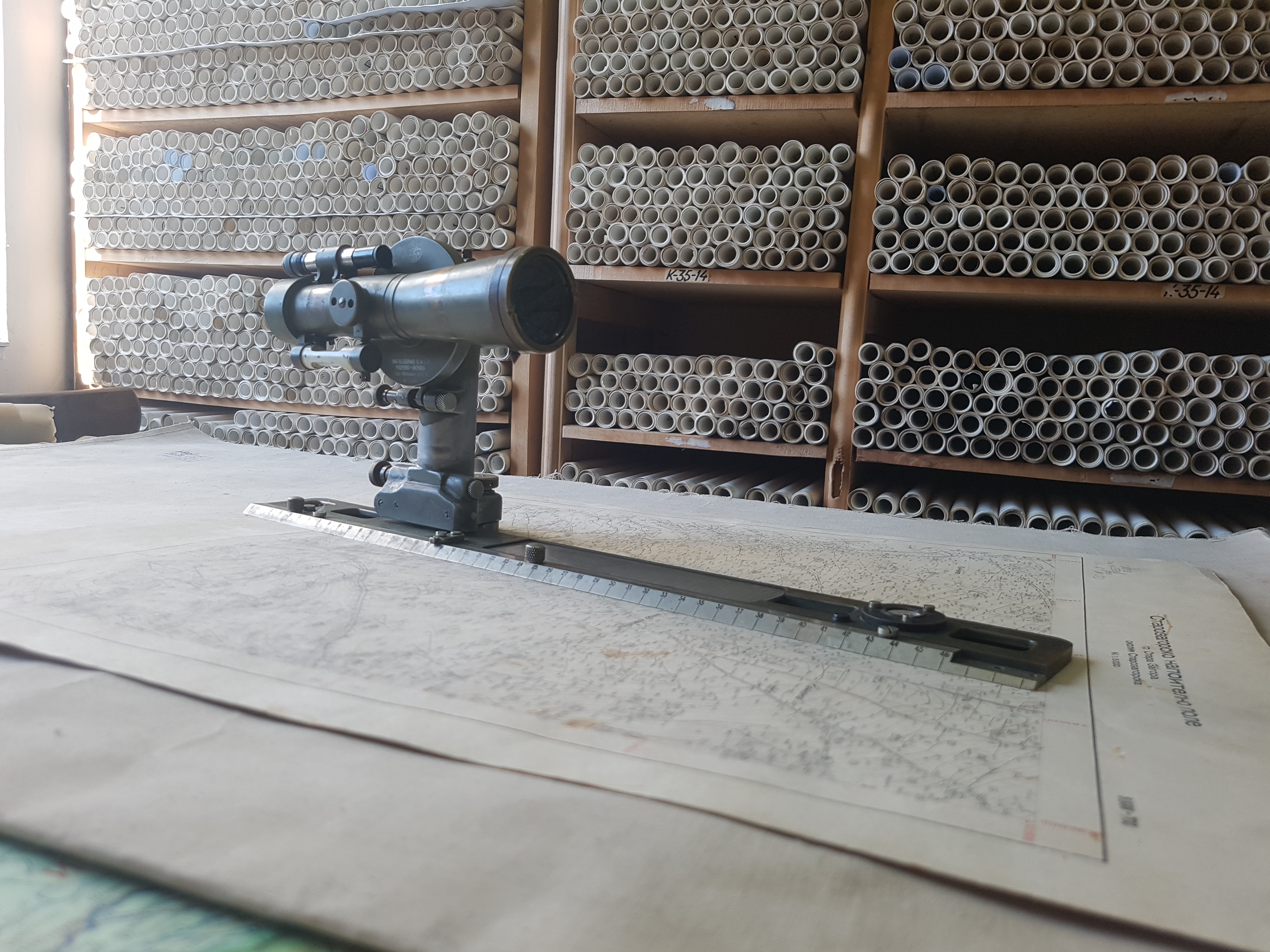
More than 600 000 images of locations from the last century can be viewed in the Geocartographic Fund at the Geodesy, Cartography and Cadastre Agency
More than 600 000 images of locations from the last century can be viewed in the Geocartographic Fund at the G
By Ministry of Regional Development and Public Works
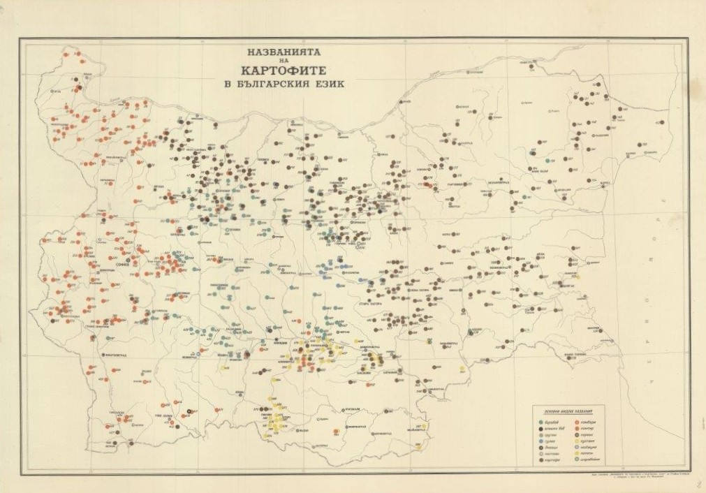

A map of the names of potatoes in the Bulgarian language is preserved, as well as a tourist guide for Pirin made in the last century
A map of the Kingdom of Bulgaria printed in Vienna, showing the borders of San Stefano Bulgaria, a map of the names of potatoes in the Bulgarian language with 14 different names such as baraboy, fava bean, savages, kombari, patati, etc. These are just some of the materials that can be seen in the Geokartfond at the Geodesy, Cartography and Cadastre Agency. It contains data from several centuries of geodetic and cartographic history of Bulgaria.
There is also an old tourist chart - a Pirin mountain guidebook, in which the heights of the main peaks and lakes are recorded; descriptions of routes with their duration, songs (including the musical notation), tips for first aid in case of frostbite, snake bite or bee bite.
Over 600,000 images (contact prints from aerial photography) of locations taken after 1952 can be seen.
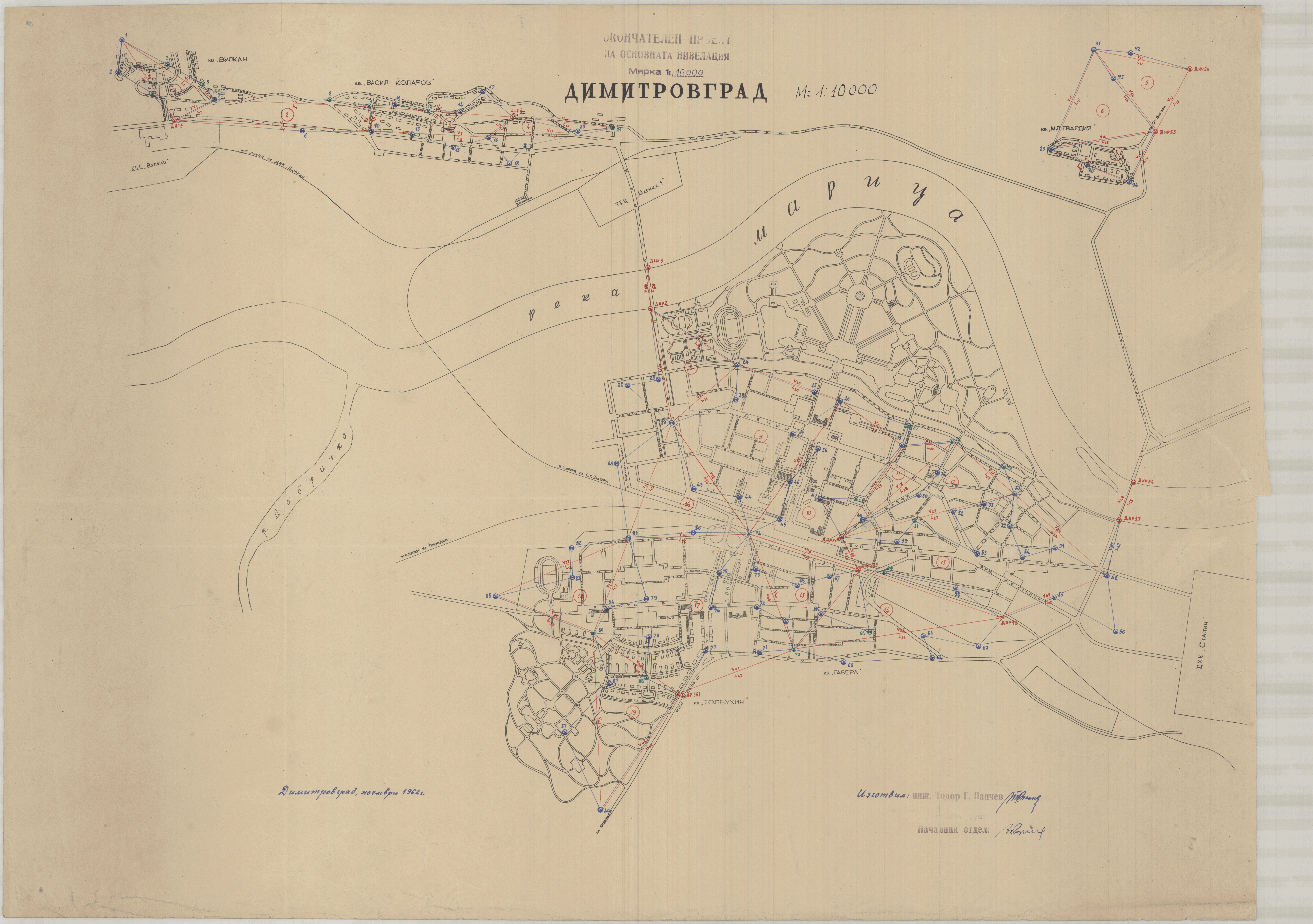
The Geomap fund holds more than 11 thousand cadastral and regulation plans of settlements made from the end of the 19th century to the 1980s. There are also more than 16,500 archival plans of agricultural land - cadastral and land consolidation plans made in the period 1926-1948.
There are also general/general and courtyard regulations and regulation plans of settlements in the country, drawn up as early as the 19th century. The oldest plan in the archive is of the town of Svishtov, made in 1882 by Ludwig Ferne.
Anyone who is interested in the geodesic and cartographic history of Bulgaria can get acquainted with the Regulatory Plan of the resort of Narechenski Mineralni Bani made in 1912. Curiously, it is inscribed with a regulation for its implementation, which introduces urban planning, health and public works rules, consistent with the times and mandatory in the construction and development of the resort.
In the Geomap fund you can see the preserved data from the gauging stations for the level of the Black Sea from 1928 to the present. There are also records of the first geodetic measurements on the territory of present-day Bulgaria, made in the period 1854 - 1855.
Also of interest are some of the first universal surveying instruments, which are still here - theodolites, cypregels, echers and drawing instruments. These instruments have now been succeeded by digital total stations and levels.
The preserved materials and data can be viewed on site at the Geomap fund at the Geodesy, Cartography and Cadastre Agency. Some of them are also uploaded in the web application of the Geodesy, Cartography and Cadastre Agency - https://gkf.cadastre.bg, as well as in the Cadastre Administrative Information System of the agency.